The Ben Ōhau hike and Greta Track should be an absolute must for anyone visiting the Mackenzie Basin Region.
These two tracks are seamlessly integrated, meaning that you can do both hikes in a 17km loop around some of the most incredible views that showcases New Zealand’s diverse scenery.
Located approximately a 22km drive from Twizel, you drive along the Glen Lyon Road which the takes you along the eastern side of Lake Ōhau.
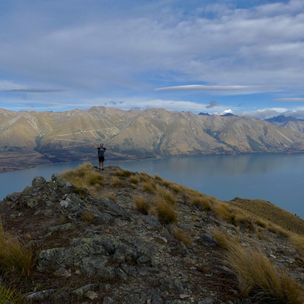
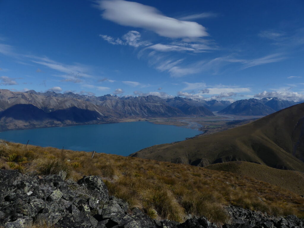
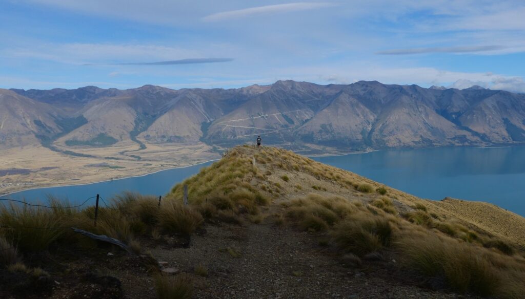
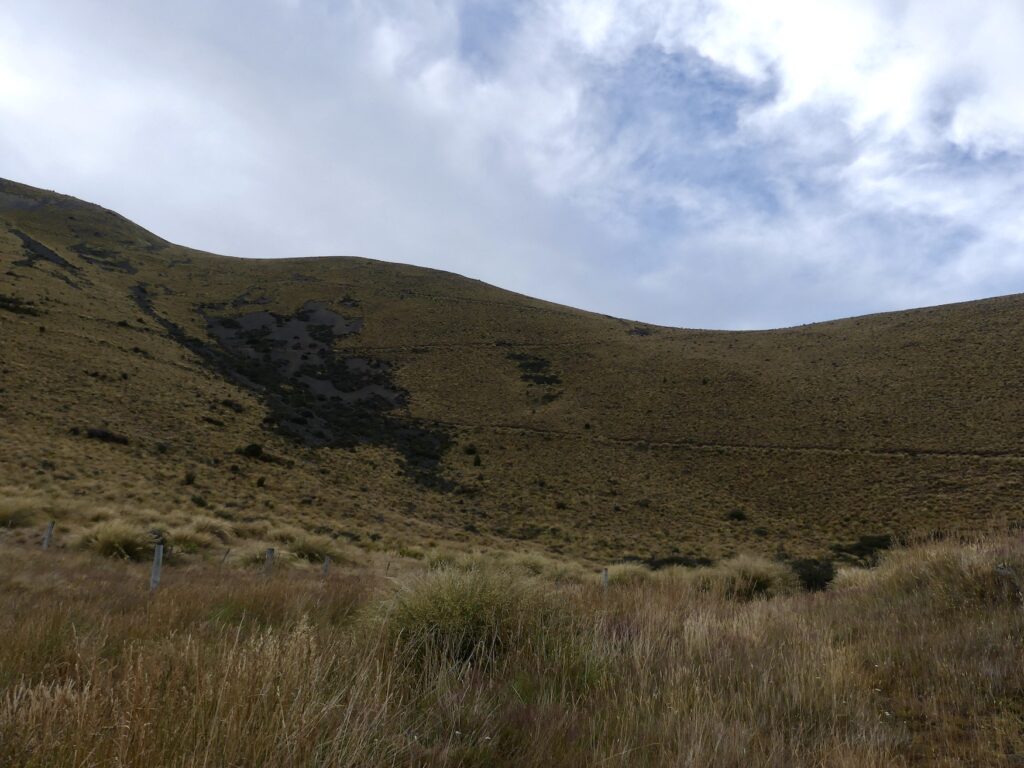
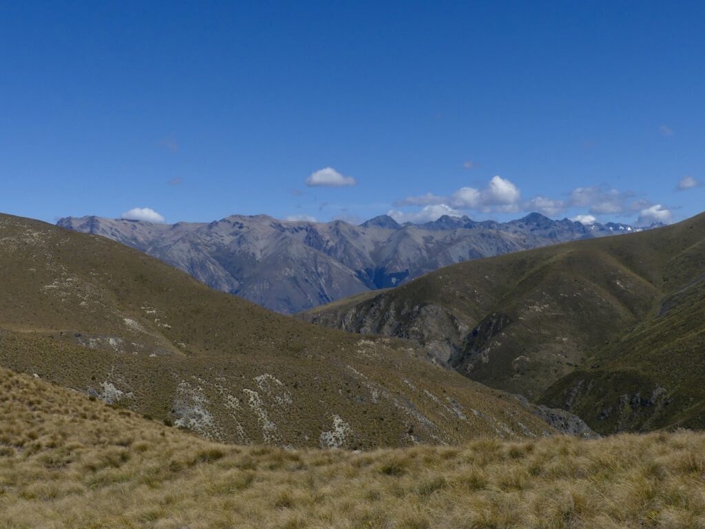
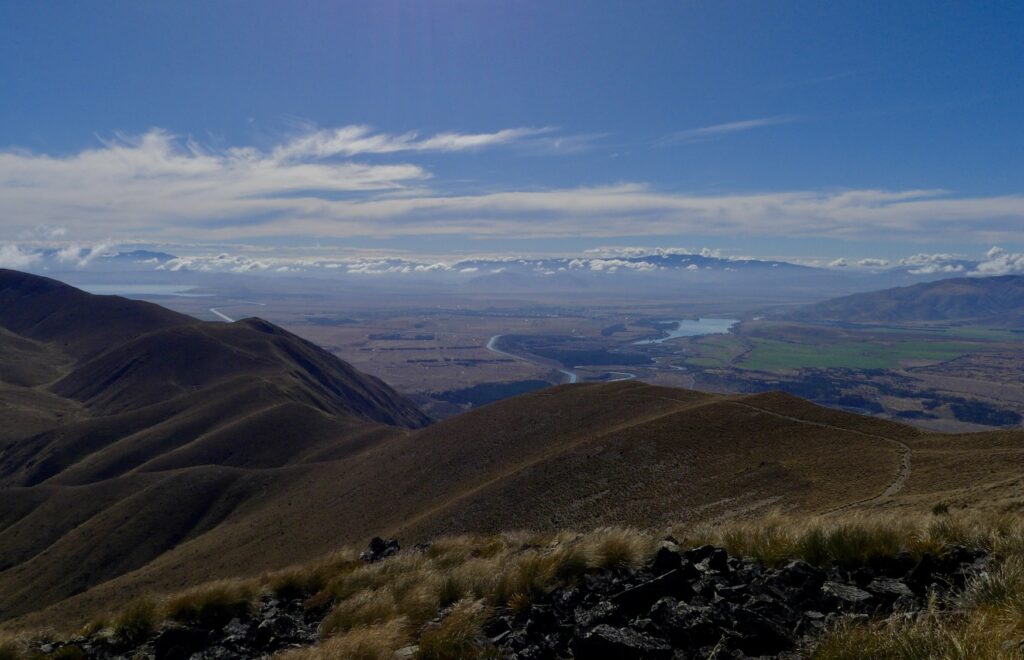
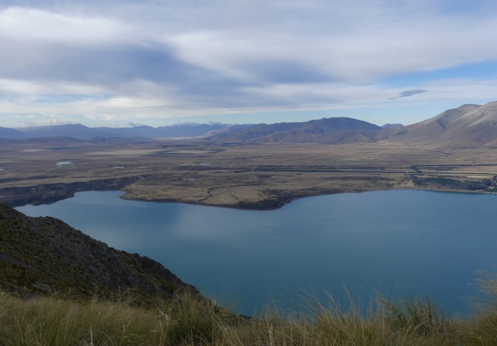
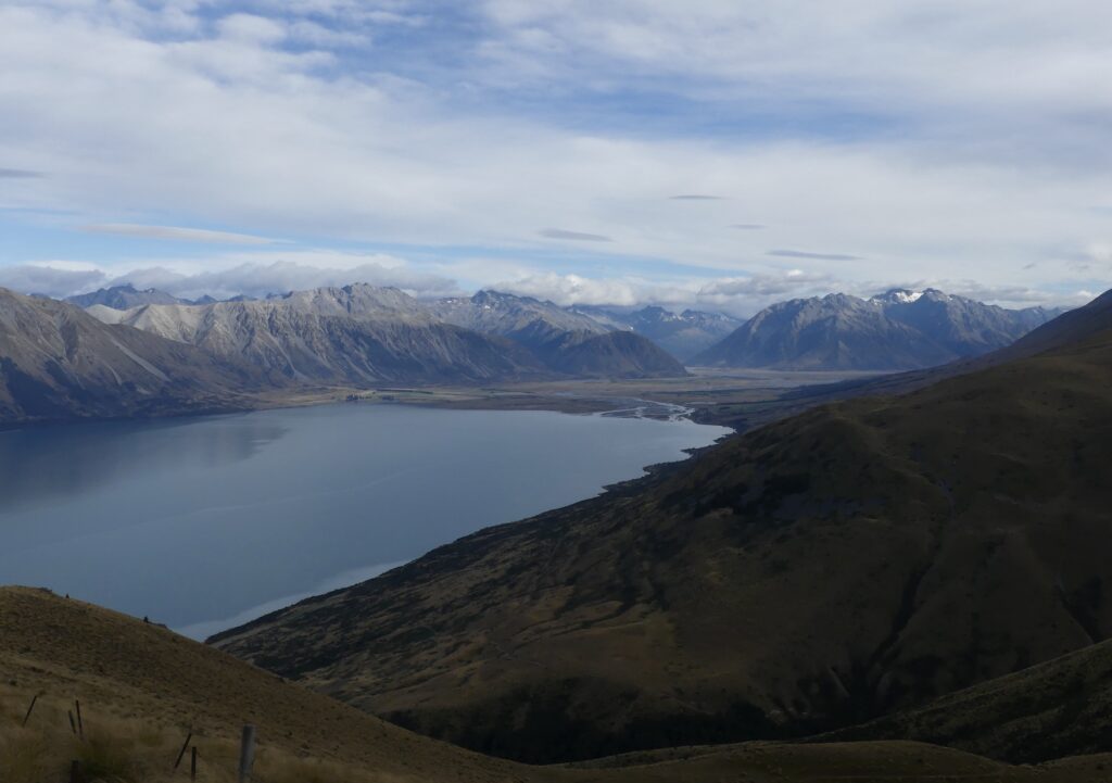
Ben Ōhau is the highest point in the local area offering 360-degree views of the Mackenzie Basin region. On a clear day you will be able to see Lake Ōhau in its entirety from certain points along the track, as well as other epic landmarks such as the Glen Mary Glacier, Lake Pukaki, and Lake Ruataniwha. Across the lake you’ll also be able to spot the access track to the Ōhau ski fields.
In this article we will provide you with all the information you need to successfully complete the Ben Ōhau hike/summit and the Greta Stream track.
This includes details about both tracks, such as:
Ben Ōhau hike length/ distance
Time
How to get there
What to pack
We will initially discuss the hikes separately as they can be completed independently from each other. However, we absolutely recommend doing both together as they complement each other beautifully.
By doing both tracks, you achieve mightily fine views of the diverse range of New Zealand’s incredible landscape- lakes, glaciers, valleys, streams and mountains. It is truly breathtaking and is absolutely a hidden gem; you’ll have a unique perspective for your travelling adventures around New Zealand.
It’s so off the beaten track we didn’t see a single person while doing it which makes a nice change from other popular hikes like Roy’s Peak.
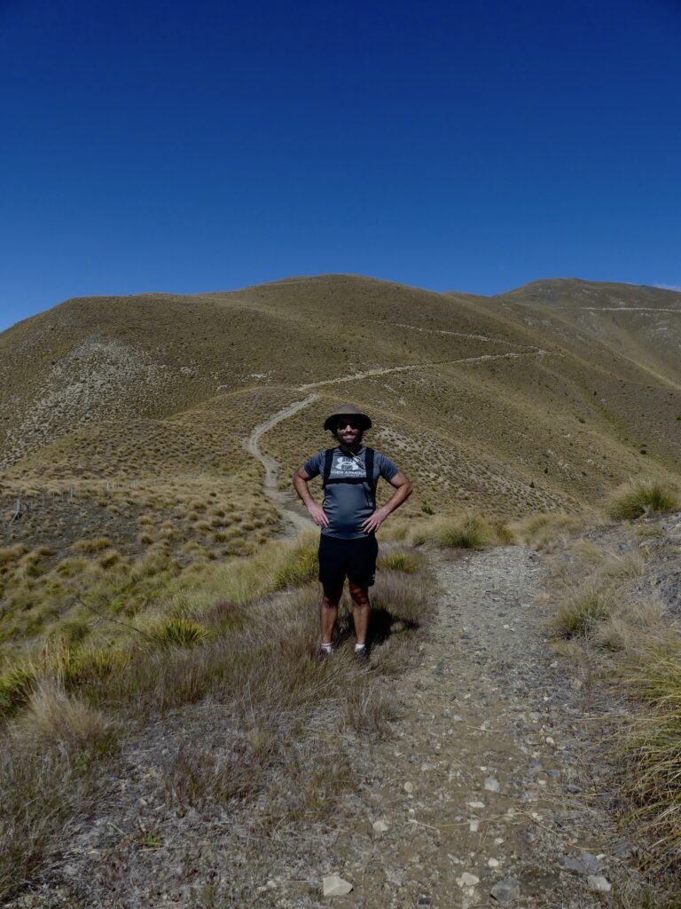
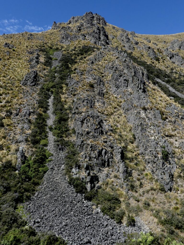
The Ben Ōhau peak walk is a tough 5k hike that climbs up to a height of 1522m. It is very much exposed to the elements, and the path zig zags and twists all the way up to the top.
Total hiking time to the top is approximately two hours, dependent upon fitness levels and how many pictures you want to stop and take.
(The DOC sign does say 2.5 hours but as with most of their signs we think that is based on a slower ascent).
A return journey would take the total hike time to approximately four hours- going down is always harder than we all think!
To start the trail, the path is very visible and easy to find from where you park (see below for more details on how to get to the car park).
By the time you have completed your first switchback, you have already climbed quite high, and your car will look small already!
From this point onwards, there is no shade. It is an exposed track, so make sure that you have the correct gear and enough water.
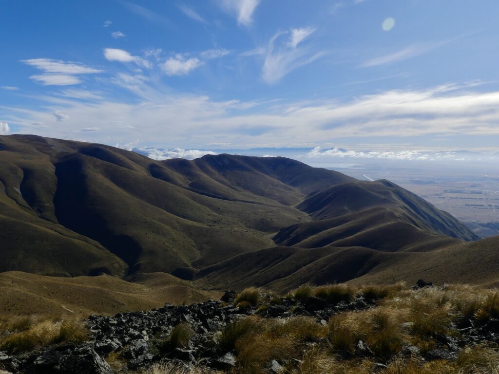
As you climb higher, the views keep getting better- obviously.
Due to the frequently changing direction of the path as it snakes its way up Ben Ohau, the views are constantly changing.
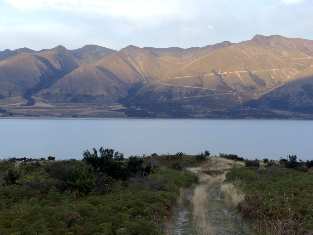
The best view of Lake Ōhau can be found at a point just before the final long stretch of path. You get an incredible panoramic view of the lake from here, with nothing obstructing the scene of the turquoise lake stretching and bending around the base of this mountainous hill. And this view is quite sudden- you will come aorund a corner and boom, there’s a fully visible lake.
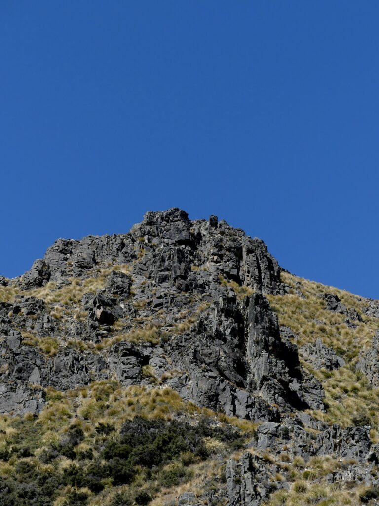
Once you’ve taken in this view, prepare for what was simultaneously the most beautiful and most difficult part of the hike; the final accent to the peak.
An important feature about the peak here is that you have to divert from the path to reach the actual summit of 1522m. This is a very obvious diversion as it’s the only point that’s significantly higher than the track, but there is no real path here- it is scrambling over rocks to the top which is about 150 metres.
Once you have completed the summit, you can either journey back along the path you’ve just ascended and return to the car park, making this hike a 10km out and back track. Alternatively, you can continue along the path and complete the Greta Track too (which we think you should do- that hard, uphill work is mostly done now!).
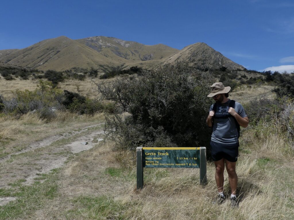
Greta Stream Track
Strictly speaking, the Greta Track includes the hike up the summit of Ben Ōhau and then follows the path around.
But if you do just want to do the Greta Stream walk, you can.
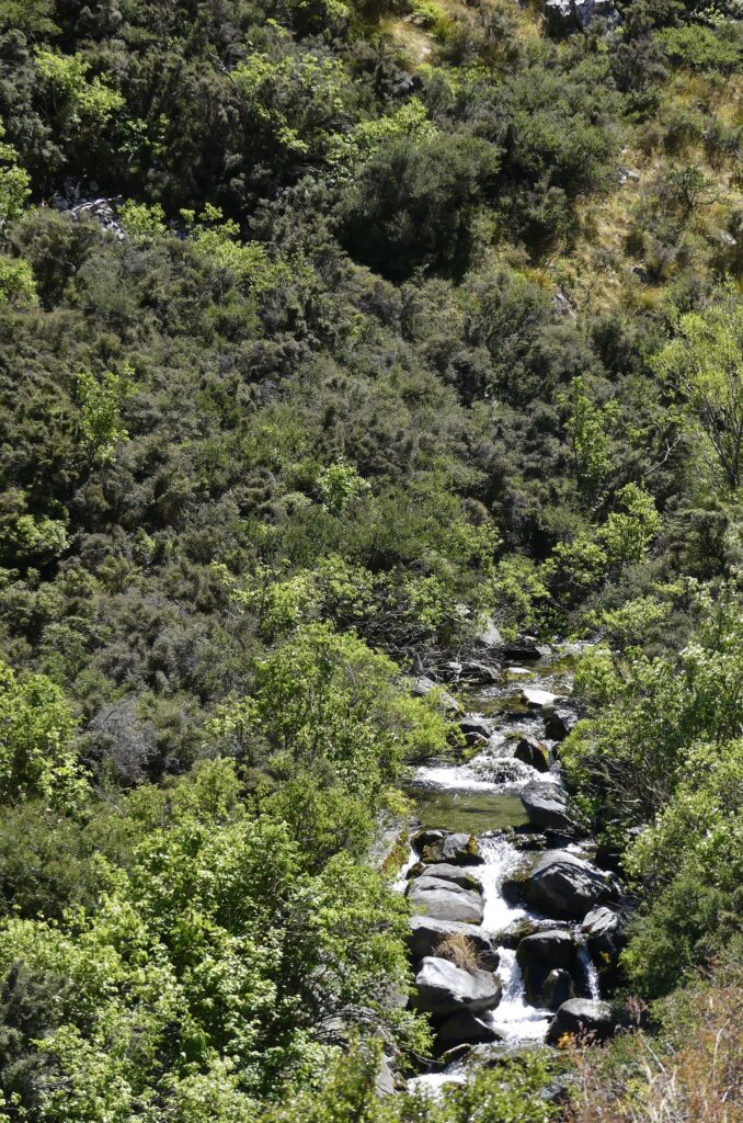
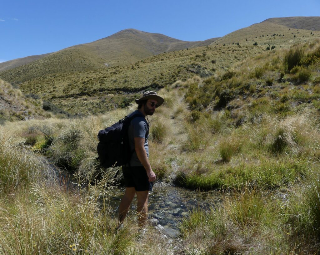
Park your car slightly further up from the Greta track trailhead parking that is used for the Ben Ōhau summit starting point. Then follow the path across a windy field until you reach a more covered area of the track by trees and shrubbery. Just continue along this track which follows the Greta Stream up through the valley.
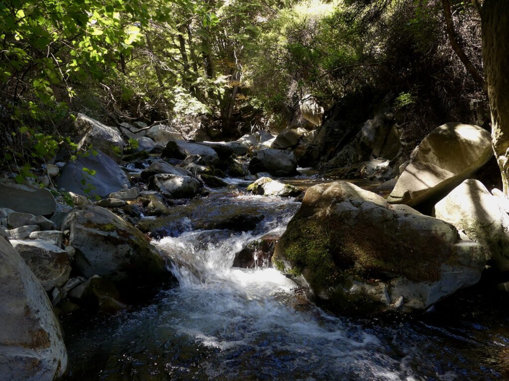
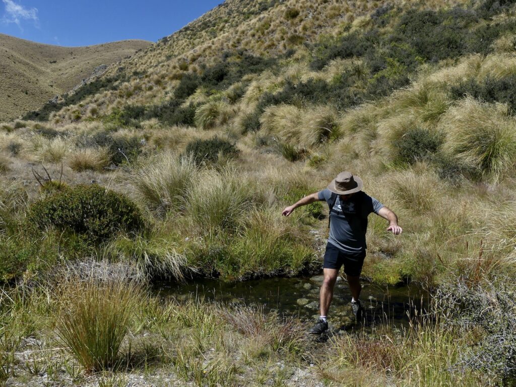
An important note here is to be prepared to get your feet wet or take your boots off as you have to cross the stream a few times. These crossings aren’t too big and there are stepping stones to help cross. If you have waterproof boots like Jess, you’ll be fine.
You can go as far as you like and turn back at any time. There are some picturesque spots along here, so a gentle stroll and lunch by the stream could be an enjoyable experience.
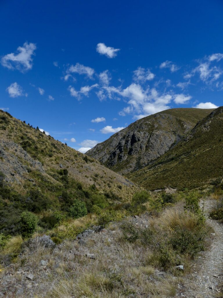
Likewise, you could follow the path fully through the valley and it will eventually connect with the Ben Ohau summit. This would be a long way to reach the summit as you have a 12km hike ahead of you to reach the summit this way. We recommend doing the hike the other way around as you get the ascent done first.
Hiking Both Ben Ōhau and Greta Stream Track Together
Hiking both trails together is a no-brainer as the tracks are seamlessly integrated. We 100% recommend doing both tracks in one hit.
If you are doing both, we suggest doing the Ben Ōhau Peak first, as it is a much gentler downhill from here on out as the hard work is mostly done.
Once you have reached the peak of Ben Ōhau, the path naturally takes you over and down.
You can actually see where the path goes from up there, so if you really don’t like the look of it then you can opt to turn back here. It is important to note though that you turn off the path you can see before going up any of the bigger hills!
For those continuing, we recommend having a minimum of two litres of water per person as it is a large hike and very exposed to the elements.
Once you are on this path, you drop quite quickly from your elevation of 1400m at the highest point of the path (not the summit as the summit is off of the path).
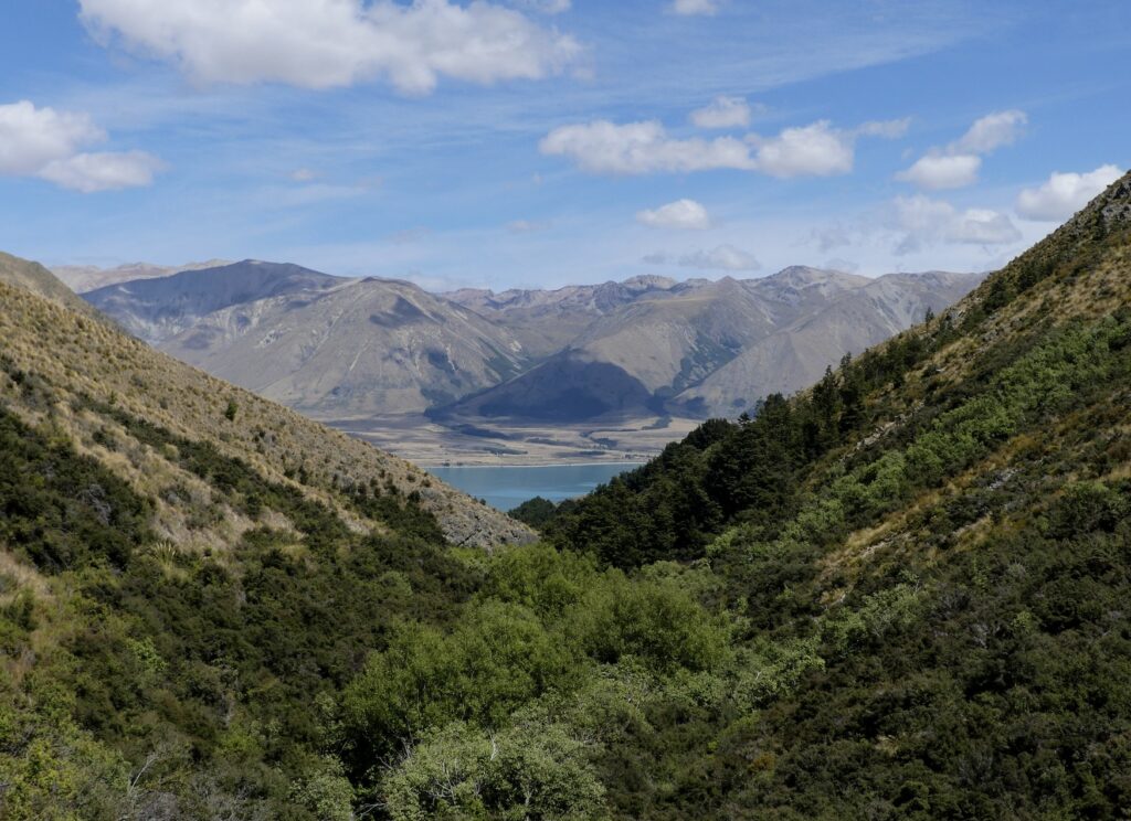
As you follow the path down, you will eventually come to the section of this hike that follows the Greta Stream. Here you will hike past many trees and bushes, such as Beech, Manuka, and Tōtara.
You’ll need to cross the stream a few times, but like we have said it’s not too difficult.
Along this stretch of your hike, you will start to see red plastic poles that lead you back to the lake and the finishing point.
To finish the hike, you have one more fairly steep hill that takes you out of the valley, and then it’s just a gentle meander back to the edge of Lake Ōhau.
Preparing for your Hike
We are assuming that you are going to do both hikes.
A packing list for this hike should include:
2 litres of water per person (minimum)
Layers, including waterproofs- you are so exposed to the weather here, and it can change at any point. Plus, at the summit you are at an altitude of 1500m which will be cold even in the height of summer (trust us)
High energy snacks- nuts and protein bars are all great hiking snacks.
Lunch- we ate sandwiches at the summit when we did it.
Sun cream – the sun will burn you (also, trust us).
Hats and sunglasses.
Camera / photography equipment – obviously, the views are incredible!
Basic first aid kit- plasters, bandages etc are all good practice to take with you on every hike.
We had had phone signal the whole way around the track so you don’t need to worry about that too much, but it’s still good practice to at least let people know where you’re heading (or even take a radio/satellite phone just in case).
With Ōhau translating to “place of wind”, having layers packed for the peak is vital. The usual westerly wind in this area means that Ben Ōhau is battered by the cold, glacial wind coming over the mountains.
To avoid having legs that look like Squashies by the end, definitely take suncream. Remember the UV level is much higher in New Zealand than most countries around the world, even when the temperature isn’t that high.
Follow all of these preparations tips and you’ll have the best time on this hike!
When is the Best Time to Hike Ben Ohau & Greta Stream?
When is the best time of year to do the Ben Ōhau summit?
This is a great hike to do throughout the year.
We recommended going in summer or very early autumn for the nicest weather and the less cold winds. If you are doing this hike in summer, then we recommend to avoid being out for the 12-3 o’clock period. The sun is at its strongest at these times and as there is no shade you will be at its mercy.
If you’re hiking Ben Ōhau in winter prepare for alpine conditions, take extra layers, crampons and poles just in case, also don’t do the scramble to the summit if it is snowy and always check the DOC site/All trails for weather conditions.
When is the best time of day to do the Ben Ōhau summit?
Sunrise. Or just after. This is always the best time to hike somewhere with views.
Starting the hike at this time also gives plenty of day light to do the rest of the loop.
We started this track at sunrise and managed to stay comfortably in the shade the whole time going up. This made the ascent a lot easier heat wise and made the views even more incredible with the beautiful morning sun!
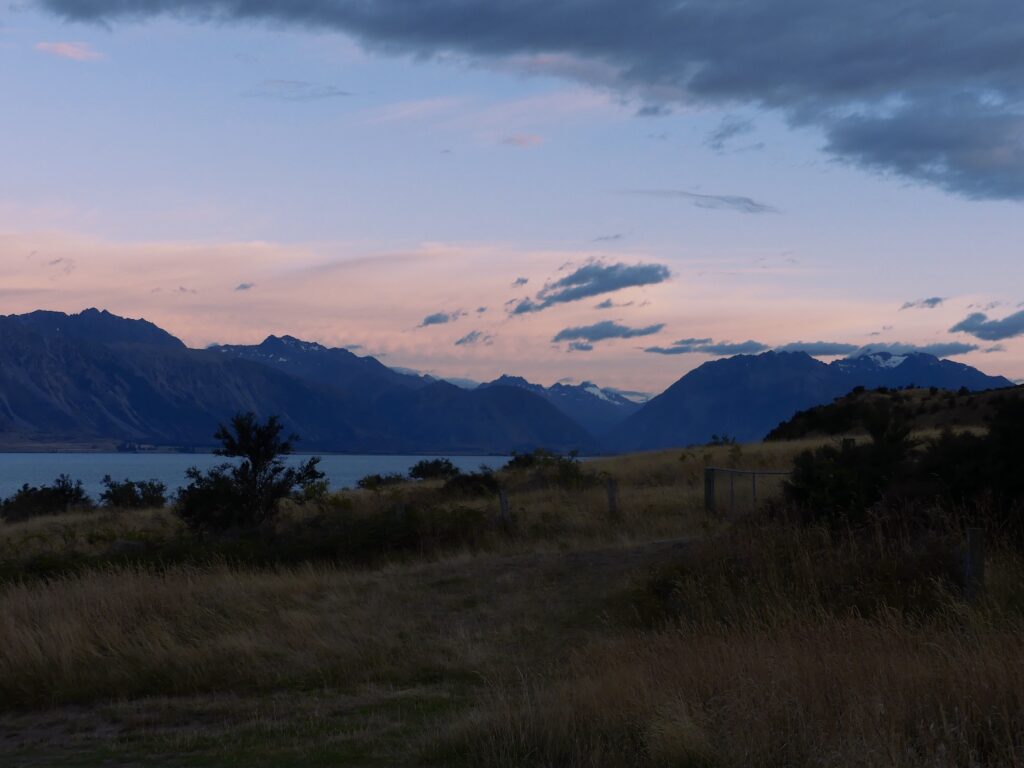
If you are hiking to do some photography, then we recommend doing this hike at sunset and only doing the Ben Ohau summit. The sun sets behind the mountains and would illuminate the entire Mackenzie Basin for you to capture. Take plenty of layers if you are doing this as the temperature will drop quickly.
How to get there
Twizel is the nearest town to this epic hike. Once you are near/in Twizel, pick up the Glen Lyon road which takes you approximately 20km out of the town.
Drive along the Pukaki canal, and eventually you will pick up a bumpy dirt track that hugs the bottom of Ben Ōhau and is right on the edge by the lake.
Take care driving along here as there are no barriers, and go slow as the bumps are pretty aggressive after 30/40 km/h.
Once you’re on this road, just follow it round for 10 or so minutes and you will very easily spot the small car park. It has a sign for ‘Greta Track Trailhead’, this is the one you want to ascend to the summit of Ben Ōhau.
Park up and enjoy your hike!
Bring a Camera
Always bring a camera. Phone quality now is great but when you really want some shots of the whole McKenzie basin or the snowy peaks of the mountains you’ll be thankful you brought it.
If you don’t own a camera that’s obviously fine but make sure your phone etc is fully charged and maybe bring a portable charger just in case.
Jess & Ben’s Thoughts
We loved this hike! It was physically challenging, incredibly scenic and extremely rewarding.
Our day saw us wake up at 5am in January (summer), and start the hike for 06:50. We had a 50-minute drive to get there plus time getting sorted and having a quick bite to eat before heading out. This food was essential by the way as we were starting to feel rather weak by the top wishing we’d eaten a bit more. But we had lunch packed so that sorted us out.
We are glad we did the hike at this time of day as we avoided the brutal sun beating down on us all day long. We were only in the sun for the section after we reached the summit. We also saw the sun rising over the mountains, illuminating the surrounding landscape. Which was quite beautiful.
This is one of the many walking tracks Lake Ōhau has to offer.
To quote Jess when asked how she found the hike for this article
“I’m burnt, it was rough, but I loved it”
If that doesn’t sell it to you then we don’t know what will! (P.s remember suncream.)
Overall, if you are looking for a hike that very few other people even know about and is exquisite in so many ways, then this is for you.
We really hope that this resource helps you on your hiking adventures around New Zealand!
Thanks for reading!
Jess & Ben
This post may contain some affiliate links that help run our website.
1 thought on “Ben Ōhau Hike And Greta Track: A Hidden Gem In Twizel, New Zealand”


Pingback: Interview Tips for a Live-in Job in New Zealand - Jess & Ben Travel